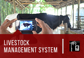
Livestock Management System
The Livestock Management System is a mobile software based product that integrates ICT mechanisms to improve monitoring and service delivery of livestock health and production management to marginalized farmers.
Learn MoreShurokkha
Solution that monitors livestock health and production for marginalized farmers at remote locations , remotely provides expert consultation via mobile based application by Para-vets and delivers online advice/prescription for cattle on emergency/typical situation by Veterinarians
Learn More